The scoutage of the Temple.

Thread started by
bentstrider at 09.22.07 - 12:07 am

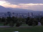
So, I was in SLC on Tuesday and decided to do a late-afternoon scouting of the hills before heading down to the buffet(mmmm BBQ chicken).
They have this thing called UTA which runs within the general city limits. The train is somewhat like the PDX MAX, except this one tends to stay within a 5-10 mile radius of the city, give/take.
Cool thing is that a line runs No-So up and along 400th-500th(streets run into each other).
500th goes up into this hilly area where the University of Utah and other adjacent facilities are located.
Not sure of the altitude at this point, but I estimate it at 800-1500 feet above the city.
Getting to the point(finally) the ride back down is quite exhilirating and risky.
Residential block walls, and the train tracks run right alongside the road. I rode down this thing during 5-7pm rush hour and cars were wanting to prove their dominance in speed on this hill.
Speed limit posted was 35, I was doing 45, 4wheelers get butt-hurt and go 50+.
Oh, and the entire length of the run was about 6-7 miles.
This is from the Army Reserve center behind the University and down to main drag of SLC.
Now I just got to find out how to paste and copy a map.
I right click a google reading and it does jack-shit!!
 -->
-->


 So, I was in SLC on Tuesday and decided to do a late-afternoon scouting of the hills before heading down to the buffet(mmmm BBQ chicken).
