The Light Purple Line

Thread started by
trickmilla at 02.17.10 - 5:42 pm
(please reply to this thread, the other one is messed up)
This is a concept for "The Light Purple Line" aka LP line or LPL for short.
It is a short route approximately 3 miles similar in some ways to 4SBB but headed in a N/S direction.
The route connects Thai Town, Little Armenia and Korea Town.
The reason it has the working title of the Light Purple Line is that I thought that if it could easily be understood as a connector between the Red Line and Purple Line, people would know exactly what neighborhoods it serves.
I combined Red and Purple and the color I came up with was called "Light Purple"
There are a few ugly intersections, that I think could easily be dealt with with some effort. The traffic is relatively light the times I have taken this route, there is lots of 4 way stops.
I think that this route, with a little attention, a few signs, some paint, and a few improvements at intersections could make this corridor much more bike/ and ped friendly.
Thoughts? Suggestions?
THE MAP: http://www.bikely.com/maps/bike-path/The-LP-Line
 reply
reply
I was trying to sink the other thread, just let it go & hopefully we can forget it ever existed...
 danya
danya02.17.10 - 5:48 pm
reply
Think that's enough to get rid of the other thread?
 danya
danya02.17.10 - 5:51 pm
reply
So the color look magenta...
Yes its true, what the hell is light purple anyway.
I used an html color mixing tool and through a purely unscientific system I came up with the color in question (FF080) in htmlspeak. I looked up that color and the interwebz says its called light purple:
http://www.computerhope.com/htmcolor.htm
But the project, in no means needs to be called the light purple line.
What ever it is it should be catchy and easy to understand.
LPL is not perfect, but i like that its uses metro's vernacular but its a color they would never use.
 trickmilla
02.17.10 - 5:52 pm
reply
By the way. I welcome other suggestions for names for this route/ corridor.
It utilizes a few different streets, (serrano, hobart, oxford) and they are pretty small and not that well known which is why I think a title like Serrano Corridor doesn't work very well.
 trickmilla
02.17.10 - 5:58 pm
reply
All right so. On to serious discussion.
What exactly are you proposing here? Another subway? A bus line? A special bike corridor? And who would need to be involved to make it happen? DOT? Metro? Just locals?
I don't see a point in a subway connecting the two, a bus line seems impractical, and since this is a bike forum I'm going to assume a bike corridor. What would you be pushing for here? Better paving? Bike lanes? Sharrows? Segregated bike corridor?
Would it simply be a good focus area for a pilot program of the DOT/BAC or should it be incorporated into the city's Bike Master Plan? Either way, I'd send it over to Bikeside/BWC and have it included in the next layer of their version of the Bike Plan.
 danya
danya responding to a
comment by trickmilla
02.17.10 - 5:59 pm
reply
If it's a bike corridor you're thinking of, I like the idea of calling it the Magenta Corridor. How awesome does that sound?
 danya
danya responding to a
comment by trickmilla
02.17.10 - 6:25 pm
reply
This is indeed meant to be a Bike and Ped corridor.
The reason I say bike and ped rather than just bike because, I think it will require the help of the local residents that live on these streets for the street to be able to go the distance.
I think it could start with a guerilla/ grass roots movements then inspire the city to do the kind of work that only the city can do. Like put in lights, official signs, official street pait and crosswalks, crossrides, etc.
 trickmilla
 responding to a
comment by danya
02.17.10 - 6:38 pm
reply
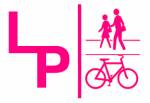
Cute logo, but it's hot pink, not light purple. So make it a light purple aka light violet shade.
 Girl Power
 responding to a
comment by trickmilla
02.17.10 - 6:54 pm
reply

Melrose is an example of a street that needs some help. There is a crosswalk, but the traffic tends to be heavy on melrose. Fortunately it is usually so heavy that when there its a red at western traffic piles up and has to stop, making an inroad to cross.
 trickmilla
02.17.10 - 7:05 pm
reply

There are some long stretches of 4 way stops which are nice, but even those parts could be improved be becoming more bike minded.
 trickmilla
02.17.10 - 7:30 pm
reply
Basically it breaks down like this.
Melrose, Santa Monica, Fountain, and Sunset are all really goofy intersections that require a some crazy moves like a quick left/right or a right/left maneuver to cross the intersection and get on the right street.
Those streets need some kind of signage, and possibly a flashing light/ bike sensors so bikes and peds can cross safely.
South of Melrose all the way to 8th its pretty much smooth sailing. with 4 way stops, and traffic lights at the major intersections.
I guess my priorities would be:
- Guide signs that direct people to the route from major streets like 4th, beverly, melrose, etc.
- Signs in the "good" sections that indicate that it is a bikeway, and drivers should watch for bike traffic. Eventually official sharrows.
- Signs that guide people through the funky intersections north Melrose.
- Identifying signs along the route so people know they are on the LPL, Magenta Bike Corridor, Western Adjacent Bikeway, or whatever. I think teh branding is important because the streets change and wind around a bit.
- Bike sensors / cross walks/ cross rides and flashing lights at the large intersections with no traffic lights.
I think some of the work could start on a guerilla basis, then move to a grass roots movement, then finally though the slow moving bowels of the DOT.
 trickmilla
02.17.10 - 7:47 pm
reply

An example of the goofy crossing at fountain.
 trickmilla
02.17.10 - 7:52 pm
reply
What about a "Pedal Train" Corridor?
Or, an old, creaky train hand-pump car being operated by a crotchety old guy, pulling some live-steam, sit-down cars?
 bentstrider
 responding to a
comment by trickmilla
02.17.10 - 8:32 pm
reply

I think its brilliant!
That would be a good job for you too bent.
I could just see you offering your quips to your passengers and you pump up and down the line "pitch in folks! I'm not doin' this for my health!"
You've got you'll be old and crotchety soon enough if you stick with it. ;-)
 trickmilla
 responding to a
comment by bentstrider
02.17.10 - 8:50 pm
reply
If all it required was commercial CDL, I'd be all over it, set for fuckin' life!!!
 bentstrider
 responding to a
comment by trickmilla
02.18.10 - 1:21 am
reply
I kind of like El Centro-Lucerne as another chill N/S route in mid-city. It's one of the few streets that manages to sneak in between the cemetery, studio, golf course and stupid gated community that break up most other routes in the area. It connects conveniently to Willoughby to the west, 2nd to the east, 4SBB going both ways, 8th-9th to the east and Country Club-11th to the east, all decent side streets that I've found quite useful.
With all the connecting routes, it looks roughly
like this.
Disadvantages: El Centro gets a bit narrow, and there are a couple blocks of Lucerne where the pavement could use a little help. Also, to be honest, I can't really remember what the stoplight/sign situation is. Perhaps I should pay more attention to these things?
 nathansnider
02.18.10 - 2:30 pm
reply
I'm starting to realize there there is lots of these little streets that just need a little attention to become more useful/ bike friendly.
Pointesttia/cochren is one that I use to get from the Santa Monica/ La brea Area all the way to mid city...
I have a feeling there is tons of these streets, but you really have to explore and experiment on your own to find them.
Its frustrating to ride a really mellow side street then come to an intersection that is impossible to cross.
 trickmilla
 responding to a
comment by nathansnider
02.22.10 - 10:17 am
reply
every once in a while i have that experience on side streets, but usually there is a break in traffic within about 30 seconds to a minute.
there's something to be said for taking quiet side streets via foot or bicycle but i think the route you've chosen is just way too complicated for where it's going. If i had to get from hollywood and western down to 8th street, i would take wilton or western everytime. i think that tricky intersection crossings like what you've prescribed at santa monica and melrose are worse than staying on the larger streets.
i think this is even more true for inexperienced cyclists. the right turn from serrano onto santa monica and then subsequent left turn onto oxford would be daunting for a seasoned rider, let alone someone who is inexperienced. that is precisely the spot where eastbound traffic on santa monica is racing to get onto the 101.
just something to think about.
 cassidy
 responding to a
comment by trickmilla
02.22.10 - 10:52 am
reply
There are definitely a lot of quiet streets that would make really nice bike corridors if the pavement was fixed up or a few lights were put in. For instance, some long sections of 9th/James M Wood and 11th have recently been resurfaced, and now they're two of my favorite E/W streets in my neighborhood. Is the goal here to focus on one route where we can lobby for specific street improvements that would establish a N/S equivalent of the 4SBB? The 4SBB itself could still use a lot of improvement, but I think it's a nice idea.
Partly because of this thread, I re-rode the El Centro-Lucerne route during rush hour last week, and I realized that 3rd street and Beverly are both hard to cross in heavy traffic, so it makes more sense to take Arden through that stretch. Arden has stoplights, and the pavement is downright
nice. Also, the southern section of Lucerne that connects to Pico is a bit hilly and narrow, so it makes more sense to take a little topographic wiggle toward the west,
like this.
That route isn't as straightforward as the one I originally posted, but it's a lot more useful.
While we're at this, what about Edgemont-Heliotrope-Catalina, as in
this route? I think that Heliotrope is probably the best N/S crossing of the 101 in the area, but Heliotrope through the Bicycle District makes for a pretty lousy bike route (crappy pavement, cars pulling out of angle parking spaces). Edgemont is a lot quieter and involves fewer wiggles going north. And then further south, Catalina is pretty nice and has lights at all major intersections except Beverly, I believe.
Of course, as much as I like the quiet side street routes that we're talking about here, I'll admit that if I'm in a rush and traffic's not too bad, I'll usually just take Vermont or Wilton to go north or south. Sometimes speediness trumps comfort.
 nathansnider
 responding to a
comment by trickmilla
02.22.10 - 3:23 pm
reply
well about 2/3 of this route is ready to go.
seriously all it would take is signs off of the major streets telling people its there.
The northern streets starting at melrose would need some creative crossing points, like the flashing lights they put in for peds ... it looks windy on the map, but it is the natural way to travel. with signs and cross points it woudl be super easy.
Roads like these really shine at rush hour and at drunk hour when one would rather be zipping down a treelined street rather than fighting for space with cars or looking over the should for speeding jackasses.
 trickmilla
 responding to a
comment by cassidy
02.22.10 - 4:58 pm
reply
i think these multi road arterials are really interesting.
Many just need some signage to direct riders.
 trickmilla
 responding to a
comment by nathansnider
02.22.10 - 5:00 pm
reply
 -->
-->


 Here is a sample logo for LPL
 This is what the map looks lke..
 Melrose is an example of a street that needs some help. There is a crosswalk, but the traffic tends to be heavy on melrose. Fortunately it is usually so heavy that when there its a red at western traffic piles up and has to stop, making an inroad to cross.
 There are some long stretches of 4 way stops which are nice, but even those parts could be improved be becoming more bike minded.
 An example of the goofy crossing at fountain.
 I think its brilliant!